


LOGAN 12 Voting District, Massac County, Illinois
About
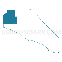
Outline

Summary
| Unique Area Identifier | 573545 |
| Name | LOGAN 12 Voting District |
| County | Massac County |
| State | Illinois |
| Area (square miles) | 29.91 |
| Land Area (square miles) | 29.11 |
| Water Area (square miles) | 0.80 |
| % of Land Area | 97.31 |
| % of Water Area | 2.69 |
| Latitude of the Internal Point | 37.28842640 |
| Longtitude of the Internal Point | -88.87581270 |
Maps


Graphs
Select a template below for downloading or customizing gragh for LOGAN 12 Voting District, Massac County, Illinois


Neighbors
Neighoring Voting District (by Name) Neighboring Voting District on the Map
- BELKNAP Voting District, Johnson County, IL
- BENTON 10 Voting District, Massac County, IL
- GEORGES CREEK 11 Voting District, Massac County, IL
- GRAND CHAIN Voting District, Pulaski County, IL
- GRANT 14 Voting District, Massac County, IL
- HILLERMAN 13 Voting District, Massac County, IL
- KARNAK Voting District, Pulaski County, IL
- VIENNA 2 Voting District, Johnson County, IL
Top 10 Neighboring County Subdivision (by Population) Neighboring County Subdivision on the Map
- Grant precinct, Massac County, IL (1,681)
- Vienna No. 2 precinct, Johnson County, IL (937)
- Hillerman precinct, Massac County, IL (892)
- Karnak precinct, Pulaski County, IL (598)
- Grand Chain precinct, Pulaski County, IL (584)
- Benton precinct, Massac County, IL (499)
- Logan precinct, Massac County, IL (351)
- Georges Creek precinct, Massac County, IL (322)
- Belknap precinct, Johnson County, IL (245)
Top 10 Neighboring Elementary School District (by Population) Neighboring Elementary School District on the Map
Top 10 Neighboring Secondary School District (by Population) Neighboring Secondary School District on the Map
Top 10 Neighboring Unified School District (by Population) Neighboring Unified School District on the Map
- Massac Unit School District 1, IL (13,893)
- Century Community Unit School District 100, IL (2,760)
- Joppa-Maple Grove Unit District 38, IL (1,446)
Top 10 Neighboring State Legislative District Lower Chamber (by Population) Neighboring State Legislative District Lower Chamber on the Map
Top 10 Neighboring State Legislative District Upper Chamber (by Population) Neighboring State Legislative District Upper Chamber on the Map
Top 10 Neighboring 111th Congressional District (by Population) Neighboring 111th Congressional District on the Map
Top 10 Neighboring Census Tract (by Population) Neighboring Census Tract on the Map
- Census Tract 9701, Massac County, IL (4,895)
- Census Tract 9778, Johnson County, IL (3,618)
- Census Tract 9710, Pulaski County, IL (3,028)